Indiana is making great strides to bringing in more hikers to their state parks. Several parks have a hiking challenge specific to that park that you can complete.
- Pokagon State Park: Hell’s Pointe Challenge
- Clifty Falls State Park: Four Falls Challenge
- Indiana Dunes State Park: 3 Dunes Challenge
- Shades State Park: 6 Ravine Challenge
- Turkey Run State Park: 5 Mile Challenge
The park we are featuring in this article is Clifty State Park. Clifty is located in the Far South East part of the state sitting right beside the Ohio River. Clifty was officially announced as an Indiana state park in 1920. Here you will experience waterfalls, ravines, and canyons created from the Ice Age.

The Challenge:
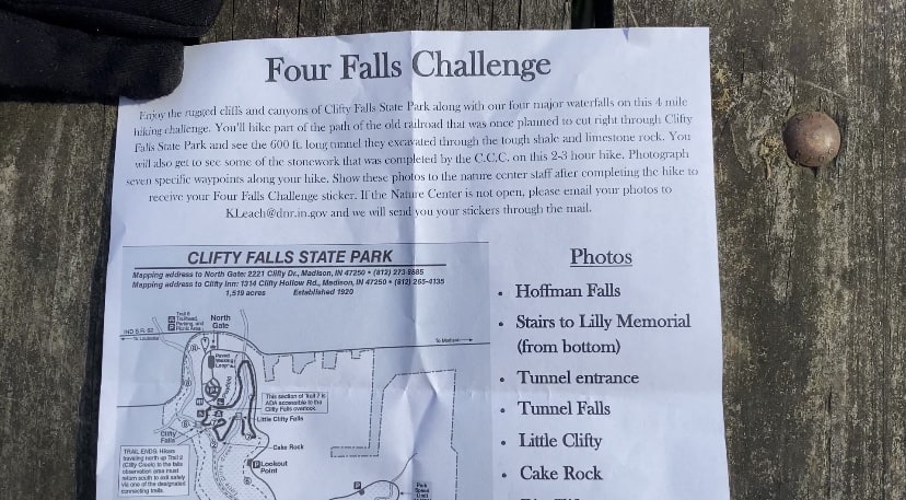
The challenge is to hike about 4 miles on two separate trails. Trail 7 loop and then drive to Tunnel Falls or Hoffman Falls trail head to complete trail 4. Now on this trail once you reach the end you will have to turn around and follow the trail back or take the road back. During this challenge you will need to visit the designated areas on the map you grab at the nature center. You will have to take selfies at the designated spots to prove that you completed the hike. Inquire about the challenge with a ranger at the Nature Center. You will be given a map with the designated areas for pictures to be taken.

The Hike:
The hike is pretty simple as far as staying on the trails. Unlike the other challenges out there where the trails are ravines and you feel like you are never on trail, this is an easily identifiable trail to follow.
We started by first knocking out the trail 7 loop. The first reason being that it has the best attractions. The parks namesake waterfalls, Big and Little Clifty are found on the trail 7 loop. The second reason we chose to do this section first was because it seemed to be the easiest to knock out quickly since the other trail could take longer as it’s an out and back. This first section is about a 1.25 mile loop that is easy to navigate.
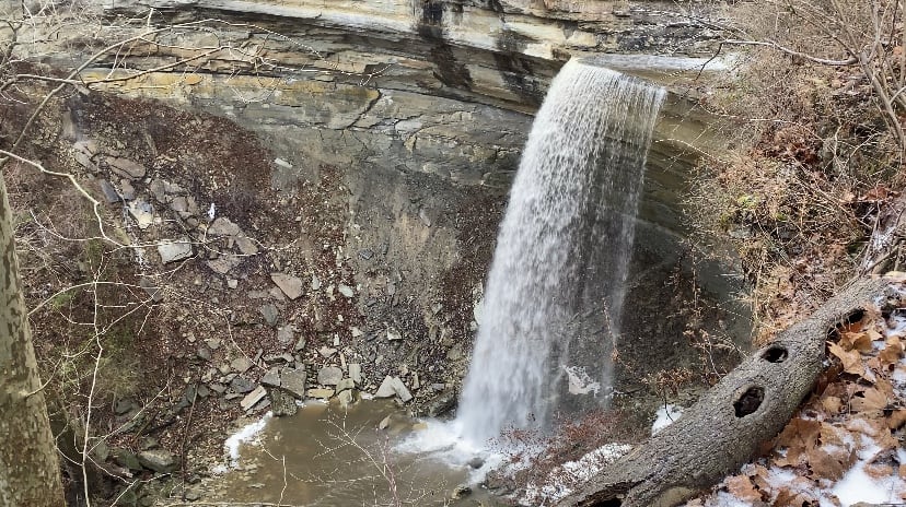
Once we completed trail 7, we headed back to the car to drive to the trailhead at Hoffman falls (you could also park at Tunnel Falls). This is the part of the challenge I was not a fan of. I wish it was a longer loop that did not involve driving. Trail 4 heads straight down past Hoffman Falls for an out and back trail of about 2.75 miles in length. This trail is pretty rugged with jagged rocks and thick roots everywhere. So, please wear appropriate shoes and bring your trekking poles if you think you’ll need the extra support on the steep areas. Along trail 4 you follow the ridge to find your other checkpoints that you will need to take pictures of. Once we reached tunnel falls for our last picture we had a decision to make. So we take the road back to the car or take the super rugged up and down trail back to the car? We opted to take the trail back because we are not fans of road hiking. Headed back from Tunnel Falls towards Hoffman Falls is a little more challenging as it goes back uphill, so take of note that if you start at the Tunnel Falls trail head.
Once you are finished and have all of your checkpoint pictures, head back to the nature center to receive your reward.
The Reward:
What do you get? Well…other than being able to say you completed this challenge, you are rewarded with a sticker. We thought they were a dollar like the other challenges, but the Naturalist instead asked that we donate it to the wishing well in the Nature Center.
